CUTTING THE COST OF DANGEROUS ROADS
A lifetime of care following a road crash can cost more than £20m. In total, Britain loses 1-2% of GDP in road crashes. The £36bn lost annually is more than is spent on GP services and primary schools combined.
Half of all Britain’s road deaths are concentrated on just 10% of the road network – the motorways and ‘A’ roads outside urban cores. This annual report maps and analyses the risks of death and serious injury on this network where so much loss of life and economic cost is concentrated.
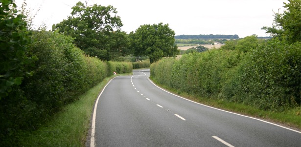
The largest single cause of death on this network is from vehicles running off the road. Brutal crashes at junctions are the largest cause of serious injury.
In 2016, the Chancellor enabled the Department for Transport to establish an innovative Safer Roads Fund to target ‘the 50 most dangerous local ‘A’ roads’ in England identified by last year’s analysis. The Safer Roads Fund rapidly triggered a new systematic and proactive approach by dozens of local authorities. High return schemes to treat roadsides, junctions and provide pedestrian facilities along these high risk routes are being prepared.
The need to act is pressing. As the economy recovers following the financial crisis, crash costs are increasing across most of Britain. Only 1% of road sections improved during the survey period. The South East of England is now the riskiest region where risks rose by nearly 10%.
The most improved road in this survey is a stretch of the A4151 in Gloucestershire. Road crashes were reduced by nearly 90% through simple attention to road engineering detail – signing, road markings, safe pedestrian crossings and the right speed limits in the right place.
Overall, the 10 most improved roads saw deaths and serious injuries fall by 74%. The crash costs saved on just these roads alone had an economic value of £17m per year.
This year’s report identifies more than 550 ‘black’ and ‘red’ sections which pose unacceptably high risk, just over 6,000km of road. The Safer Roads Fund has no shortage of candidates for its next priority tranche.
The Road Safety Foundation has collaborated with Ageas to provide a new interactive Road Crash Index to complement this report. This enables anyone to look up how their county ranks in recent safety improvement and see the cost of road crashes locally.
Downloads:
‘Cutting the Cost of Dangerous Roads’: Full British EuroRAP 2017 results report
GB EuroRAP Risk Map 2017 – English Strategic Road Network
GB EuroRAP Risk Map 2017 – Parliamentary Boundaries
GB EuroRAP Risk Map 2017 – East Midlands Region
GB EuroRAP Risk Map 2017 – East of England Region
GB EuroRAP Risk Map 2017 – North East Region
GB EuroRAP Risk Map 2017 – North West Region
GB EuroRAP Risk Map 2017 – Scotland Region
GB EuroRAP Risk Map 2017 – South East Region
GB EuroRAP Risk Map 2017 – South West Region
GB EuroRAP Risk Map 2017 – Wales Region
GB EuroRAP Risk Map 2017 – West Midlands Region
GB EuroRAP Risk Map 2017 – Yorkshire and the Humber Region
Main press release (more detailed)
Hi, I have travelled north on M11 between J8 and J10 most weekdays for the last 15 years. When the clocks change in autumn I witness, on the Southboound side that there are regular accidents on one short-ish downhill section in the Wendens Ambo area. This causes regular 4-5 miles of tailbacks. In my opinion some streetlighting here could prevent these. This road shows as green/safe due to the traffic volume etc. Who would be interested /responsible for looking at this matter?