IRELAND EURORAP RESULTS 2008: RISK & STAR RATING OF IRELAND’S MAJOR ROADS
Ireland has made progress with the building of motorways and dual carriageways, and has fixed the worst of the country’s single carriageways in the last few years. But the long stretches of single carriageway roads on the network continue to be a major safety hazard and a serious challenge for the road authorities north & south.
Today (May 20, 2008) Mr Noel Dempsey TD, Minister for Transport was formally presented with the EuroRAP Ireland report 2008 – the European Road Assessment Programme report highlighting the current road infrastructure conditions across the entire island of Ireland.
The report shows the results of an analysis of the safety performance the major road network. 7,600km of routes were assessed; 5,400 in the Republic and 2,200 in Northern Ireland. The assessment was carried out under the EuroRAP methodology which allows for accurate comparison between road performance in Ireland and across Europe.
Almost 95% of our deaths and serious injuries happen on single carriageway roads. This is unsurprising given our geography. But EuroRAP uses a five year statistical base (2002 – 2006) of flow data, collision data and a number of other criteria to describe which single carriageways are the worst.
Risk rating analyses the collision history on the network, which is defined by the number of collisions divided by the traffic flow. These results are broken into five bands: High Risk, Medium to High Risk, Medium Risk, Low to Medium Risk, and Low Risk. These are shown on the Risk Rate map.
Key Findings

In 2005 the EuroRAP report found 96km of the network in the Republic was classified as ‘Black – High Risk’. All of those links have now been treated, and overall the 2008 report finds that there are no ‘High Risk’ sections on the network.
The analysis does identify 350 kms of ‘Red – Medium to High Risk’ sections (there were 463kms in 2005). The report lists ten ‘Medium-High Risk’ links (147 kms). All of these are single carriageways and all have now been targeted with action plans by the NRA.
Out of 125 stretches of road assessed in Northern Ireland, 112 have improved or remained within the same risk band. This confirms that despite the economic growth and the increase in vehicular traffic throughout the region, there have been significant benefits from the installation of targeted collision remedial and route treatment schemes. 103kms of ‘Red – Medium to High Risk’ lengths have been identified and targeted for action.
Fred Barry, NRA CEO, said “While it is encouraging to note that the new road network does achieve a high star rating more work is required on the remaining National Primary and Secondary Network.”
Conor Faughnan, AA Ireland, said “The road authorities and AA Ireland have a very close working relationship, with the common goal of increasing road safety on the entire island of Ireland. It is critical to highlight this information and use it as a tracking mechanism for future progress. EuroRAP identifies problems clearly and commits us to fixing them.”
Geoff Allister, the acting Chief Executive of Roads Service, said “Improving road safety is a key a priority for Roads Service. Although we must never be complacent, it is pleasing to see that risks for drivers using the EuroRAP network in Northern Ireland have reduced considerably. It is also encouraging to note that roads previously identified as priorities for action have all recorded improvements in safety performance. As roads engineers, we have our part to play in assessing risks and managing risks on the road network through the provision of road improvements.”
List of identified priorities for action – Republic of Ireland
| Road | From-To | County | Length Km | Killed & Seriously Injured 2002 – 2006 |
| N53 | M1 to NI Border | Louth | 10.7 | 25 |
| N2 | Monaghan to NI Border | Monaghan | 16.2 | 41 |
| N14 | NI Border to N13 | Donegal | 19.8 | 71 |
| N59 | Ballina to Dromore West | Mayo | 25.0 | 60 |
| N5 | Longford to Cloonsgannagh | Longford | 13.8 | 31 |
| N67 | Ennistymon to Miltown malbay | Clare | 15.6 | 20 |
| N62 | Templemore to Roscrea | Tipperary | 18.2 | 29 |
| N81 | Closh Cross to Tullow | Carlow | 8.94 | 15 |
| N72 | Castletownroche to Fermoy | Cork | 15.1 | 19 |
| N30 | Enniscorthy to Jamestown | Wexford | 4.15 | 11 |
List of identified priorities for action – Northern Ireland
| Road | From-To | County | Length Km | Killed & Seriously Injured 2002 – 2006 |
| A2 | Glenariff to Ballycastle | Antrim | 21 | 21 |
| A3 | Moira to Lisburn | Antrim | 11 | 22 |
| A29 | Moneymore Road | Tyrone | 4 | 13 |
| A50 | Portadown to Banbridge | Armagh | 13 | 22 |
| A54 | Castledawson to Kilrea | L’Derry | 24 | 17 |
| A509 | Enniskillen to ROI Border | Fermanagh | 29 | 17 |
Road Protection Score – Star Ratings for Road Quality

The report also publishes the results of the first developmental Star Rating assessment for Irish roads. This is a way of analysing the network to see how much protection the road will provide the driver with should the driver lose control of their vehicle. It looks at the three broad categories of collisions which can be effected by road design:- Head-on, Run-off, and Intersections. The network is surveyed by approved EuroRAP consultants who assign a Star Rating to the road. Star Ratings from 1 through 4 are assigned to the road network, with a 1 star road being the lowest category.
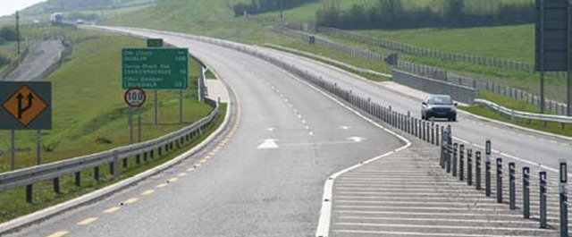
The Star Rating map shows the results of this analysis on the surveyed network. In Northern Ireland, 620kms of strategic corridors were assessed. In the Republic, 1,100 kms of paired routes were assessed. The results indicate that while the existing historic non-designed single carriageways have a poor star rating the newly constructed Motorways and Dual Carriageways all achieved a very high Star Rating.
Notes for Editors
- EuroRAP – the European Road Assessment Programme is a not for profit association which was formed by motoring organisations and roads authorities throughout Europe to work together for improvements to the safety of Europe’s Roads. It is a sister programme to the EuroNCAP which crash tests new cars and gives them a rating for safety.
- EuroRAP produces maps showing the risk of traffic collisions on the road network and maps showing the protection the road provides to the car occupant when a collision occurs. It gives roads authorities and drivers a clear comparative analysis of how their roads are performing compared to others, both in their own country and in other countries.
- Participation in EuroRAP is one of the commitments contained in the Government’s road safety strategy, noted as action point no 114.
- This is the second risk rating map – the first having been published in 2005. This map shows the progress that has been made over the last number of years. Since the first publication in 2005 all the ‘Black, High Risk’ Sections have been removed.
- The NRA is implementing a EUR1.25bn per annum programme of major schemes, a significant proportion of which is for implementing Government policy in ensuring the completion of the new Interurban network of Motorways and Dual Carriageways to N6 Galway, N7 Limerick, N8 Cork and N9 (Waterford). These will be completed by 2010.
- In 2001 there was approx 250km of motorway/dual carriageway in the Republic of Ireland. By 2006 this figure had risen to 625 km and by 2010 it will have risen to 1250km – nearly 4 times what it was at the start of the decade. This will bring the Republic of Ireland up to ‘Best Practice’ levels in other countries with 23% of the national network being motorway or dual carriageway, which is a similar figure to that in the UK.
- There is a significant Road Safety benefit from the infrastructure programme. It is estimated that this road construction programme will contribute to approximate savings of fifty (50) lives per year when completed in 2010, making it a major contributing factor to reducing road deaths in Ireland.
- Despite an increase in population of 17 per cent in the Republic of Ireland since 1996 and an increase in register vehicles of 71 per cent, there has been a 20 per cent reduction in road fatalities
- The Northern Ireland Executive’s Investment Strategy has proposed a level of investment of GBP3.1 Billion to 2018 earmarked to improve Northern Ireland’s strategic and other roads to the highest safety standards as well as improving journey time reliability.

